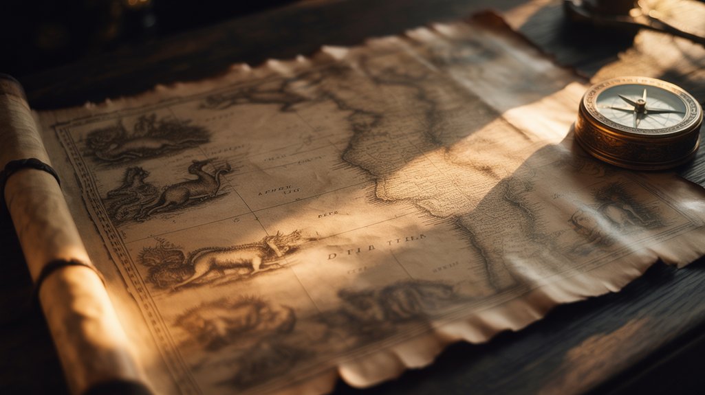
Medieval cartographers positioned chimeric creatures—dragons, sea serpents, and monstrous races like headless Blemmyes—at epistemic boundaries where empirical knowledge yielded to theological speculation. You'll find these beings weren't mere decoration; they encoded maritime hazards, marked spiritual vulnerability zones beyond Christendom's reach, and converted geographic ignorance into navigational warnings. The Carta Marina of 1539 deliberately placed monsters near documented shipwrecks, creating mnemonic devices that guaranteed sailors respected perilous waters. These cartographic confessions reveal how medieval societies mapped both terrestrial geography and metaphysical anxieties, until the Age of Exploration's empirical verification gradually erased such liminal guardians from newly charted territories.
🔮 Enhance Your Practice With These Essentials
Chosen for ritual alignment and energetic correspondence.
🔮 Enhance Your Practice With These Essentials
Chosen for ritual alignment and energetic correspondence.
🎯 Recommended Products
Handpicked items related to this article:
As an Amazon Associate, we earn from qualifying purchases.
🔮 Enhance Your Practice With These Essentials
Chosen for ritual alignment and energetic correspondence.
Key Takeaways
- Medieval maps used mythical creatures to mark dangerous waters, with dragons indicating shoals and sea serpents warning of violent currents.
- Monsters symbolized boundaries between Christian civilization and pagan chaos, representing spiritual and geographic limits of known world.
- Creatures functioned as mnemonic devices, encoding survival knowledge near documented shipwrecks to help sailors navigate safely.
- Monstrous races like Blemmyes and cynocephali illustrated theological anxieties about difference and areas of weak Christian influence.
- Ancient travel accounts from explorers like Marco Polo transformed speculation into cartographic fact until empirical verification replaced mythology.
The Purpose Behind Populating Map Margins With Monsters
When cartographers of the twelfth through sixteenth centuries inscribed their vellum charts with dragons coiling beyond Cathay's borders and cynocephali prowling Africa's unmapped interior, they weren't merely decorating empty space with whimsical doodles.
Medieval monsters on maps marked epistemic boundaries where navigable geography surrendered to theological speculation and civilizational anxiety.
These eldritch marginalia held profound significance—serving as epistemic boundaries between the known world you could navigate and the chimeric territories where geographical certainty dissolved into theological speculation.
You'll discover cultural reflections embedded in every monster. European mapmakers positioned these creatures as warnings, marking where Christ's dominion yielded to pagan chaos.
The blemmyae, headless men with faces embedded in their chests, stood sentinel over Ethiopian highlands. Sea serpents writhed through uncharted Atlantic waters, their scales gleaming with your civilization's deepest anxieties about transgressing divine order.
These weren't fantasies. They represented lived medieval cosmology—a worldview where monsters inhabited liminal spaces between empirical observation and sacred understanding, guarding thresholds you crossed at existential peril.
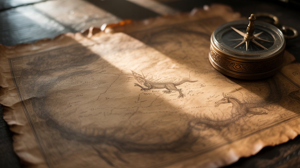
Dragons and Sea Serpents as Markers of Dangerous Waters
When you examine the cartographic practices of medieval Europe—particularly those flourishing between the thirteenth and sixteenth centuries—you'll discover that dragons and sea serpents weren't merely decorative chimeric forms but rather constituted a sophisticated symbolic warning system.
Their coiled bodies were deliberately positioned along treacherous coastlines, reef-laden passages, and storm-prone waters where countless vessels had vanished beneath eldritch depths.
These serpentine guardians evolved from crude marginalia into precise geographic markers, their placement patterns correlating with documented shipwrecks, whirlpools, and the territories of hostile seafaring cultures.
Sailors who understood this iconographic language could interpret a beast's orientation, its open maw or raised crest signaling specific maritime perils that converted parchment maps into survival tools rather than abstract representations of an unknown world.
Symbolic Warning System Evolution
How did cartographers change their legitimate fears of oceanic perils into a sophisticated visual language that would endure for centuries?
You'll discover that medieval mapmakers converted raw terror into deliberate symbolic warnings, encoding maritime hazards through chimeric beasts. By the thirteenth century, dragons coiling through uncharted waters signaled treacherous currents, while serpents marked regions where ships vanished.
These weren't mere decorations. Each creature represented accumulated knowledge—centuries of lost vessels, drowned sailors, catastrophic storms. The mythical symbolism evolved from crude sketches into standardized iconography, creating a universal lexicon that transcended linguistic barriers.
Portuguese cartographers refined these conventions during their fifteenth-century explorations, establishing protocols that merged empirical observation with eldritch imagery.
You're witnessing humanity's first attempt at standardizing danger communication across cultures, preserving freedom through shared understanding.
Geographic Placement Patterns
While medieval cartographers scattered mythical beasts across their vellum charts with apparent randomness, closer examination reveals deliberate geographic patterns that mapped genuine maritime dangers with startling precision.
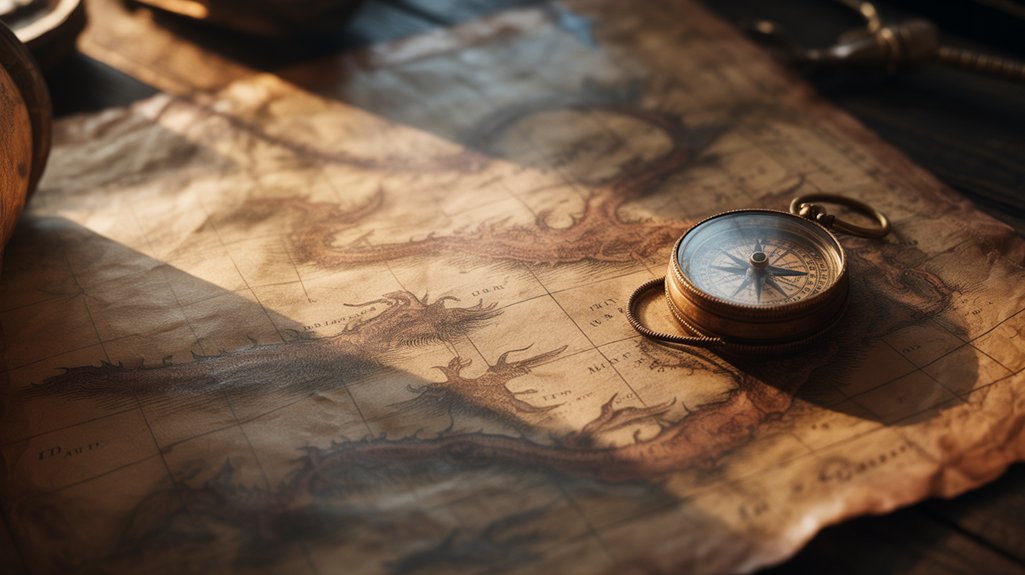
You'll find dragons coiled around treacherous shoals where ships foundered. Sea serpents undulated through waters where currents shifted violently, their chimeric forms encoding navigational warnings sailors couldn't ignore.
This cartographic symbolism altered abstract peril into visceral imagery—eldritch creatures marking reefs, whirlpools, uncharted depths. Medieval geography wasn't mere decoration. It was survival knowledge.
The Carta Marina of 1539 positioned specific monsters along Norway's coastline where documented shipwrecks occurred. Each beast served as mnemonic device, converting sterile coordinates into unforgettable warnings.
You're witnessing practical mysticism: ancient cartographers translating lived experience into mythological language that transcended literacy, speaking directly to primal human instinct.
Navigation Impact on Sailors
As sailors traced their fingers across medieval portolans in dimly-lit ship cabins, those illustrated monsters functioned as three-dimensional warnings—not mere ornamentation but coded intelligence that could mean the difference between safe passage and catastrophic loss.
You'd find eldritch serpents coiled around rocky shoals where currents turned treacherous, chimeric beasts marking reefs that shattered hulls.
Navigation challenges intensified when cartographers positioned dragons near magnetic anomalies that threw compasses into chaos.
These weren't sailor superstitions born from rum-soaked imagination—they represented empirical data encoded in mythological form, altering abstract danger into visceral imagery that illiterate crew members could instantly comprehend.
The monsters became mnemonic devices, their grotesque forms embedding survival knowledge directly into maritime consciousness, ensuring that even greenest sailors respected waters where experienced navigators had previously perished.
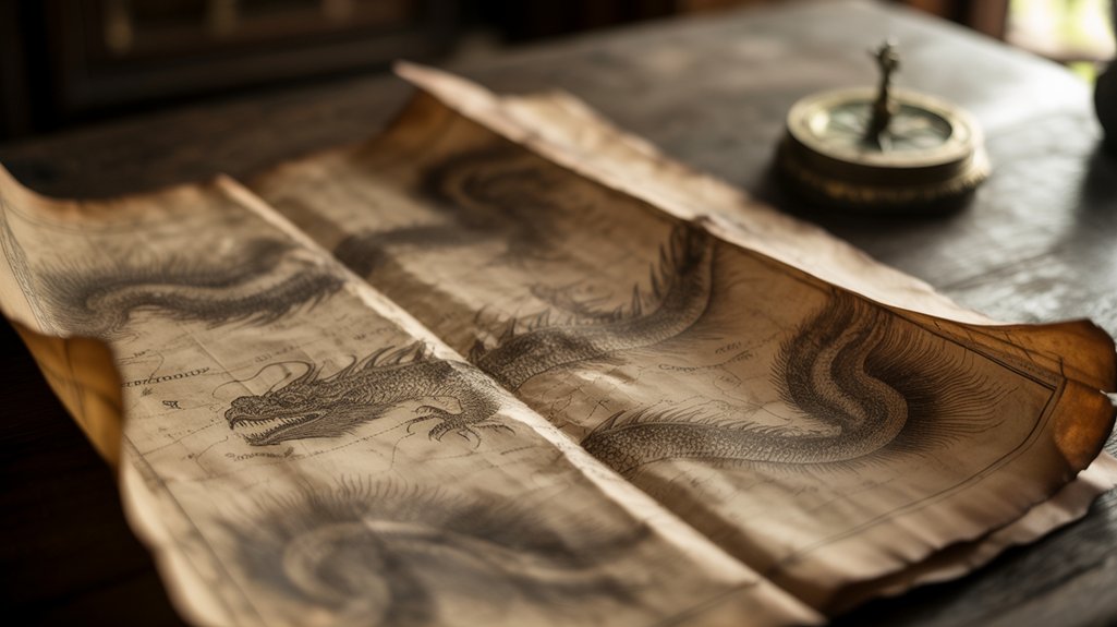
The Monstrous Races: Blemmyes, Cynocephali, and Sciapods
Beyond the known territories of medieval cartography stretched vast unmapped regions where chroniclers placed populations of wondrous deformity—the monstrous races whose anatomical impossibilities challenged both theological doctrine and empirical observation.
You'll discover Blemmyes representation across numerous mappae mundi, depicting headless beings with faces embedded in their torsos—a chimeric inversion of human anatomy that emerged from Pliny's *Natural History* (77 CE).
The Cynocephali characteristics included dog-headed warriors who communicated through barking, their canine features symbolizing the untamed edges of Christendom.
Sciapods mythology presented single-legged giants who used enormous feet as parasols against desert heat.
These monstrous races weren't mere fantasy—they embodied medieval folklore's attempt to categorize difference, serving as cultural symbolism for spiritual boundaries.
Each eldritch form marked territories where known world dissolved into possibility, where you'd find your civilization's edges mapped through anatomical otherness rather than geographical coordinates.
Theological Justifications for Fantastical Beings on Maps
Three foundational doctrines anchored the theological legitimacy of placing fantastical beings upon medieval maps: Augustine's principle of divine plenitude, the Great Chain of Being's hierarchical cosmology, and scriptural precedent from marvels described in biblical margins.
You'll find these chimeric entities served profound theological symbolism. Augustine argued God's infinite creativity demanded exhaustive expression—every conceivable form must exist somewhere. The monstrous races weren't errors but divine signatures.
| Theological Framework | Cartographic Application |
|---|---|
| Divine Plenitude | Validates existence of eldritch beings |
| Great Chain of Being | Orders creatures hierarchically |
| Biblical Marvels | Authorizes mythical interpretations |
| Moral Geography | Links monstrosity to spiritual distance |
Medieval cartographers weren't fantasists but theologians mapping divine intention. Each creature marked humanity's relationship to salvation. Distance from JerusalemCorrelated with moral degradation. These weren't decorative flourishes—they were cosmological statements. The map became scripture's visual companion, charting both terrestrial geography and metaphysical truth through beings inhabiting creation's remotest thresholds.
Warning Signs Versus Artistic Embellishment
Though modern viewers perceive medieval maps as whimsical artworks, contemporary mariners and travelers understood the essential distinction between ornamental flourishes and genuine navigational warnings.
You'll find these warning signs embedded within deliberate artistic choices, each creature positioned with cartographic precision along treacherous coastlines, uncharted waters, and territorial boundaries where sovereignty dissolved into chimeric uncertainty.
The eldritch symbolism functioned through three distinct mechanisms:
- Scale differentiation: Dangerous creatures appeared larger, dominating their maritime territories with menacing proportions.
- Strategic placement: Warning signs clustered near documented shipwrecks, violent currents, and hostile indigenous populations.
- Textual annotations: Latin inscriptions distinguished decorative beasts from legitimate hazards.
These maps served voyagers seeking freedom through exploration while acknowledging genuine perils.
Serpents coiling around Cape Bojador weren't mere embellishment—they marked psychological and physical boundaries.
The cartographer's art balanced aesthetic grandeur with practical counsel, altering parchment into protective talisman for those daring enough to challenge unknown horizons.
How Ancient Travel Accounts Shaped Cartographic Creatures
When Marco Polo returned from Cathay in 1295, his testimony of dog-headed men, magnetic mountains capable of extracting iron nails from passing vessels, and birds large enough to carry elephants didn't merely entertain Venetian salons—it fundamentally altered European cartographic imagination. You'll discover how ancient narratives changed geographical speculation into visual certainty.
Cartographers absorbed these travel accounts as empirical data, inscribing chimeric beings onto parchment with scholarly precision:
| Traveler | Century | Documented Creatures |
|---|---|---|
| Herodotus | 5th BCE | Gold-guarding griffins, one-eyed Arimaspians |
| Pliny the Elder | 1st CE | Blemmyes (headless men), Sciapods (umbrella-footed) |
| Marco Polo | 13th CE | Roc birds, cynocephali |
Travel mythology became cartographic orthodoxy. Each explorer's account layered new eldritch forms onto terra incognita, creating composite geographies where empiricism merged with wonder. These testimonies weren't dismissed as fantasy—they represented encounters with unknowable frontiers, preserved through mapmaking's authoritative lens.
The Relationship Between Terra Incognita and Mythical Populations
Beyond the cartouche's ornate borders lay something far more significant than geographical uncertainty—terra incognita functioned as ontological necessity, a designated domain where the natural order bent toward the impossible.
Unknown territories weren't gaps in knowledge but philosophical necessities—spaces where reality itself could transgress its own boundaries.
You'll find that medieval cartographers populated unknown territories with deliberate purpose, embedding terra incognita myths as philosophical statements about humanity's cosmic position.
These chimeric inhabitants served three critical functions:
- Theological boundaries marking Christian lands against pagan wilderness
- Political justifications legitimizing colonial expansion into “monstrous” territories
- Epistemological frameworks defining civilization through its eldritch opposites
The mythical populations' significance transcends mere decoration.
Blemmyae, cynocephali, and sciapods weren't cartographic whimsy—they were liminal guardians inhabiting the threshold between known and unknowable.
Each creature encoded specific anxieties about cultural encounter, environmental extremes, and divine order.
Your ancestors understood something profound: monsters don't populate empty spaces. They define them.
Regional Variations in European Mapmaking Traditions
The geographical imagination that conjured these monstrous borders manifested differently across Europe's cartographic workshops, each regional tradition encoding distinct theological anxieties and commercial imperatives into their representations of the unknown.
Italian maritime charts, born from Genoese and Venetian trade routes, rendered the Mediterranean's edges with chimeric guardians protecting lucrative Eastern passages. German workshops infused their maps with Nordic eldritch beings—sea serpents coiling through Arctic waters reflected centuries-old Scandinavian sagas.
You'll find Catalan atlases blending Islamic astronomical precision with Christian eschatology, their margins populated by cultural symbolism drawn from three continents. Regional influences shaped every cartographer's pen: English mappae mundi emphasized Jerusalem's centrality with apocalyptic beasts guarding paradise; French ateliers favored encyclopedic bestiaries positioned according to Aristotelian climate zones.
These weren't mere decorations. Each creature encoded local knowledge systems, commercial secrets, theological certainties. The monsters spoke your language, reflected your fears, guarded your particular vision of world's end.
The Decline of Monsters During the Age of Exploration
As Portuguese caravels rounded Africa's Cape of Good Hope in 1488, Bartolomeu Dias didn't encounter the dog-headed cynocephali that earlier maps had positioned along those shores—he found instead Khoikhoi settlements, established trade networks, navigable coastlines.
This empirical verification catalyzed cartographic alteration, as declining beliefs in chimeric fauna yielded to verifiable observation, though the shift occurred gradually, reluctantly, across decades of exploration impact.
The eldritch creatures vanished through three distinct mechanisms:
The cartographic imagination contracted through observation, commerce, and method—three forces that expelled wonder from the margins of the known world.
- Direct observation replaced speculation—sailors returned with documented evidence rather than fantastical accounts.
- Commercial imperatives demanded accurate charts for profitable ventures, not decorative mythology.
- Scientific methodology emerged, privileging reproducible data over inherited wisdom.
Yet something profound was surrendered.
The medieval mappae mundi had honored mystery, acknowledging unknowable territories where imagination legitimately dwelt.
As dragons retreated from oceanic margins, cartography gained precision but lost its sacred acknowledgment of wonder—that liminal recognition that some spaces transcend measurement, existing beyond empirical conquest.
What Cartographic Creatures Reveal About Medieval Anxieties
When cartographers inscribed blemmyae—headless humanoids with faces embedded in their chests—along African peripheries, they weren't documenting zoological specimens but externalizing profound cultural terrors about corporeal transgression, theological boundaries, divine order's fragility.
These cartographic fears materialized as chimeric guardians protecting civilization's edges from chaos itself.
You'll find medieval Europe's deepest anxieties encoded in these eldritch marginalia.
Sea serpents coiling around Scandinavian waters represented uncontrollable forces threatening maritime commerce, spiritual corruption seeping through porous borders.
Dragons hoarding treasure in Eastern territories? Economic anxieties about distant kingdoms, Islam's expanding influence, trade routes controlled by foreign powers.
The mythical symbolism wasn't decorative. It was diagnostic.
Cynocephali—dog-headed men—embodied fears of humanity's bestial nature, paganism's persistent threat, conversion's incompleteness.
Each monster mapped precise theological coordinates where Christendom's light dimmed, where souls risked damnation.
These weren't fantasies. They were cartographic confessions revealing what medieval society couldn't directly articulate about itself.
Frequently Asked Questions
Did Medieval Sailors Actually Believe the Sea Monsters on Maps Were Real?
You'll find sailor beliefs existed in complex layers—some mariners genuinely feared eldritch leviathans lurking beyond charted waters, while others understood monster symbolism as cartographic warnings of treacherous currents, reefs, political boundaries.
This wasn't simple credulity but practical navigation merged with cosmic uncertainty.
Medieval seafarers inhabited liminal spaces where empirical observation and numinous dread intertwined, where chimeric beasts represented both tangible dangers—storms, whirlpools, hostile territories—and humanity's profound recognition that vast oceanic domains remained fundamentally unknowable, untamed.
Which Medieval Map Contained the Most Mythical Creatures?
The Carta Marina (1539) reigns supreme—you'll discover over 100 eldritch beings populate its Nordic waters, rendering all mythical map comparisons obsolete.
Through creature density analysis, this Swedish masterpiece reveals serpentine leviathans coiling around Iceland's shores, chimeric sea-swine devouring sailors near Norway, grotesque cetaceans breaching Scandinavian fjords.
Olaus Magnus crafted more than cartography; he mapped humanity's primordial terror of oceanic unknowns.
You're witnessing maritime mythology's zenith, where empirical geography dissolves into liminal wonder, granting you freedom to explore civilization's darkest, most sublime imaginings.
How Did Cartographers Decide Where to Place Specific Monsters on Maps?
You'll discover cartographers wielded mythical symbolism as deliberate encoding—placing dragons where terra incognita stretched beyond empire's reach, serpents coiling through unmapped seas.
Their cartographic creativity merged theological doctrine with travelers' accounts, positioning chimeric beasts according to classical authorities like Pliny, Isidore of Seville.
Placement wasn't arbitrary but encoded meaning: basilisks marked African deserts, cynocephali haunted Asia's edges.
Each creature served as geographic cipher, warning and wonder intertwined, altering blank parchment into sacred cosmography where knowledge met eldritch mystery.
Were There Maps That Depicted Only Real Animals Instead of Mythical Ones?
You'll discover that Renaissance-era portolan charts, emerging from Genoese and Catalan workshops between 1300-1500 CE, prioritized real animal depictions for coastal navigation—depicting seals, whales, dolphins with startling historical map accuracy.
These practical instruments eschewed chimeric embellishments. Trade demanded precision.
Yet even learned cartographers like Abraham Ortelius couldn't fully abandon the eldritch unknown; their maps of Africa and Asia retained serpents alongside documented fauna, revealing humanity's persistent tension between empirical observation and ancient wonder.
Did Non-European Cultures Also Include Mythical Creatures on Their Medieval Maps?
You'll discover that non-European maps teemed with their own chimeric beings.
Islamic cartographers inscribed djinn-haunted deserts across twelfth-century atlases, while Chinese cosmographers populated their territorial scrolls with dragons guarding sacred mountains—creatures embodying qi's eldritch flow through landscape.
Japanese Buddhist maps, particularly fourteenth-century mandala-style works, depicted oni and tengu within geographical space.
These weren't mere decorations; they represented spiritual territories, cosmological truths.
Each culture inscribed its own mythical creatures onto parchment, altering geography into sacred narrative, mapmaking into metaphysical documentation.
Conclusion
When you trace the fading ink of a 1482 *Ptolemy* map, its chimeric sentinels dissolving beneath your fingertips, you're witnessing cartography's metamorphosis from sacred cosmology to empirical science. These eldritch guardians—once theological certainties marking creation's mysterious peripheries—became obsolete as explorers charted actual coastlines. Yet their presence reveals something profound: medieval mapmakers weren't depicting geography alone but humanity's collective psyche, where terra incognita demanded monsters to contain our deepest fears about what dwelled beyond Christendom's lantern-light.